Although the July 19th flooding “was the worst flash flooding” the county has experienced since Emergency Management Specialist Matt Miziorko began monitoring storms in 2013, there were no serious injuries or damage to the landscape.
He credits the 35 flood sensors installed throughout the county in 2023. By the end of this month, five new sensors, each costing about $5,000, will be installed in the upcounty area.
Last week, four watershed areas — Sligo Creek, Rock Creek, the Northwest Branch in the Colesville area and Cabin John Creek — all quickly crested well above flood stage.
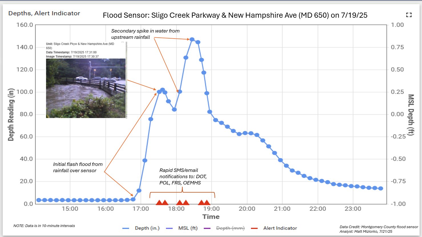
The Sligo Creek by New Hampshire Avenue crested at 145 inches, rapidly rising in about 30 minutes. That creek by Schuyler Avenue rose 150 inches, which Miziorko said he had never seen.
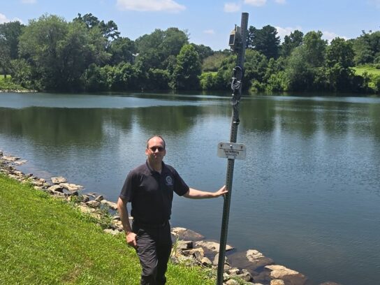
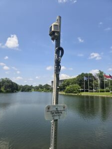
These sensors are solar powered. Through cables and cameras, they enable the county’s emergency staff to know where possible flooding will occur. The still camera shows a 60-degree image of the surrounding body of water, Miziorko said.
Listen here as Emergency Management Specialist Matt Miziorko explains how the county’s flooding sensors operate.
Flood sensors throughout the county let emergency personnel know when to send out Alert Montgomery messages and which roads need to be closed. @mymcmedia pic.twitter.com/p2QoVI8XN1
— suzanne pollak (@SuzannePollak) July 24, 2025
As soon as it becomes apparent that a body of water is going to flood, the county issues warnings on its Alert Montgomery system to area residents. Crews quickly are sent to the area to close off roads and warn walkers and bikers to leave the area.
Thanks to the sensors, “Now we can make an informed decision. We can get out ahead of this,” Miziorko said. “Our goal is to eliminate as many rescues as possible.”
The sensors are important even before the rains begin. Miziorko said that about a week prior to the recent flooding, camera images showed that lots of vegetation was growing at one area along Sligo Creek. Crews were sent out to weed the area, which “paid off,” he said.
The county also is working to avoid flooding problems in other ways with the goal of reducing water runoff. Shade trees are being planted, and community gardens are expanding. Efforts to reuse water as much as possible are underway, said County Executive Marc Elrich.
Flooding will be more common due to global warming, noted Sarah Kogel-Smucker, the county’s climate change officer. With each degree of warming comes a 4% increase in water vapor in the area, she explained.
Added Elrich, “I think mostly we are going to be seeing a new normal, and the new normal is not good.”
According to the Metropolitan Washington Council of Governments, nearly 40% of road miles throughout the region are at risk of flooding during heavy rains, which is almost three times what Federal Emergency Management Agency (FEMA) maps suggest.
WHAT CAN YOU DO TO STAY SAFE
- Sign up for Alert Montgomery
- Heed warnings
- Clean gutters and down spouts of debris
- If driving, turn around. Don’t drown
Here is a graph showing how quickly water levels rose on Sligo Creek Parkway and New Hampshire Avenue on July 19.


Comments are closed.